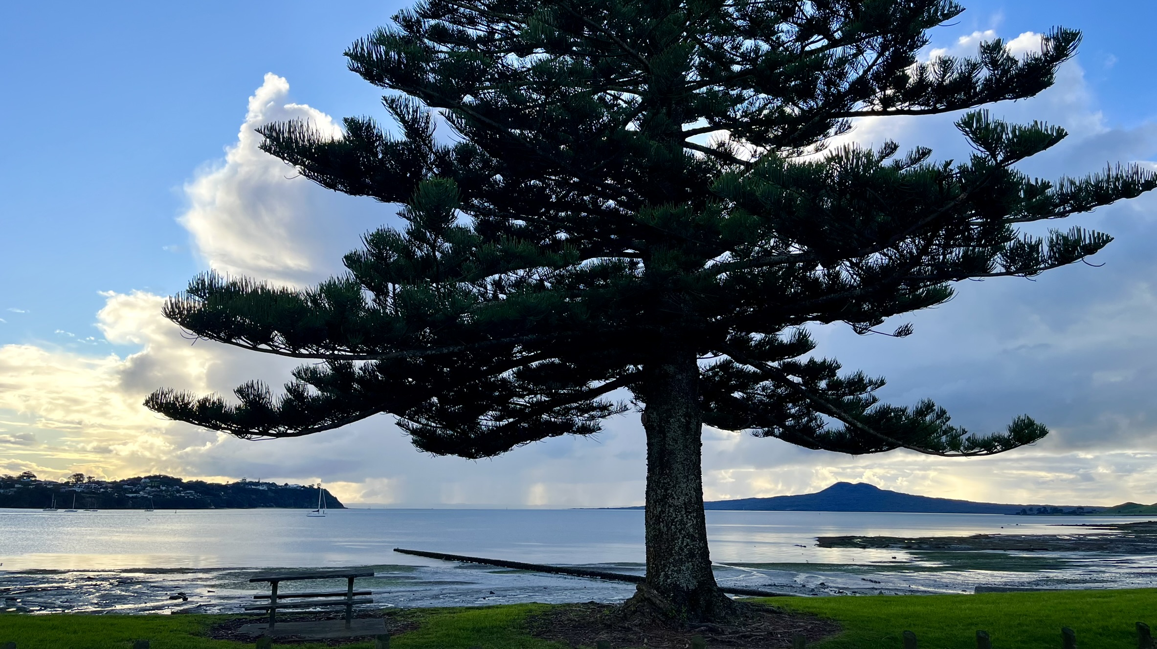
Buckland Beach
Here we have another example of impeccable planning. Just kidding, I looked up when the ferries left and was out of the house for this trip in less than an hour. And I had lunch during that time. What I discovered in my quick research was that the last ferry which would take me to Buckland Beach in a reasonable time left 12:25, and I found that out at around 11:30. So I threw together some mandarins, a water bottle and some clothes, washed my glasses and then gulped down some noodles and was out the door at around 12:10. The only problem being that it’s more than two kilometres away from Carlaw to the ferry terminal, and I had fourteen minutes before the ferry left. Twelve minutes of intermittent running and swift walking and a very winded Jonatan got onto the ferry with about a minute to spare.
I always get so happy being out on the water, feeling the wind in my face and the salt in the air. Not to mention the views in Auckland Harbour is nothing to scoff at with mighty Rangitoto in the background and the other grass covered volcanic islands around. After around twenty minutes we turned into Half Moon Bay and went past the very long sandbank stretching out into the middle of the bay. Then off the ferry and I started walking through the local marina northward up the peninsula. Which screeched to a halt when I discovered that the pocket on my backpack where I store my glasses was open, and with only my sunglasses in there. After maybe 15 minutes of panic where I was about to call the ferry company and cancel my trip to go back and search the road to the terminal, I finally got my wonderful roommate to confirm that they were in fact on my desk, I had just forgotten them in the hurry (explains why the pocket was open).
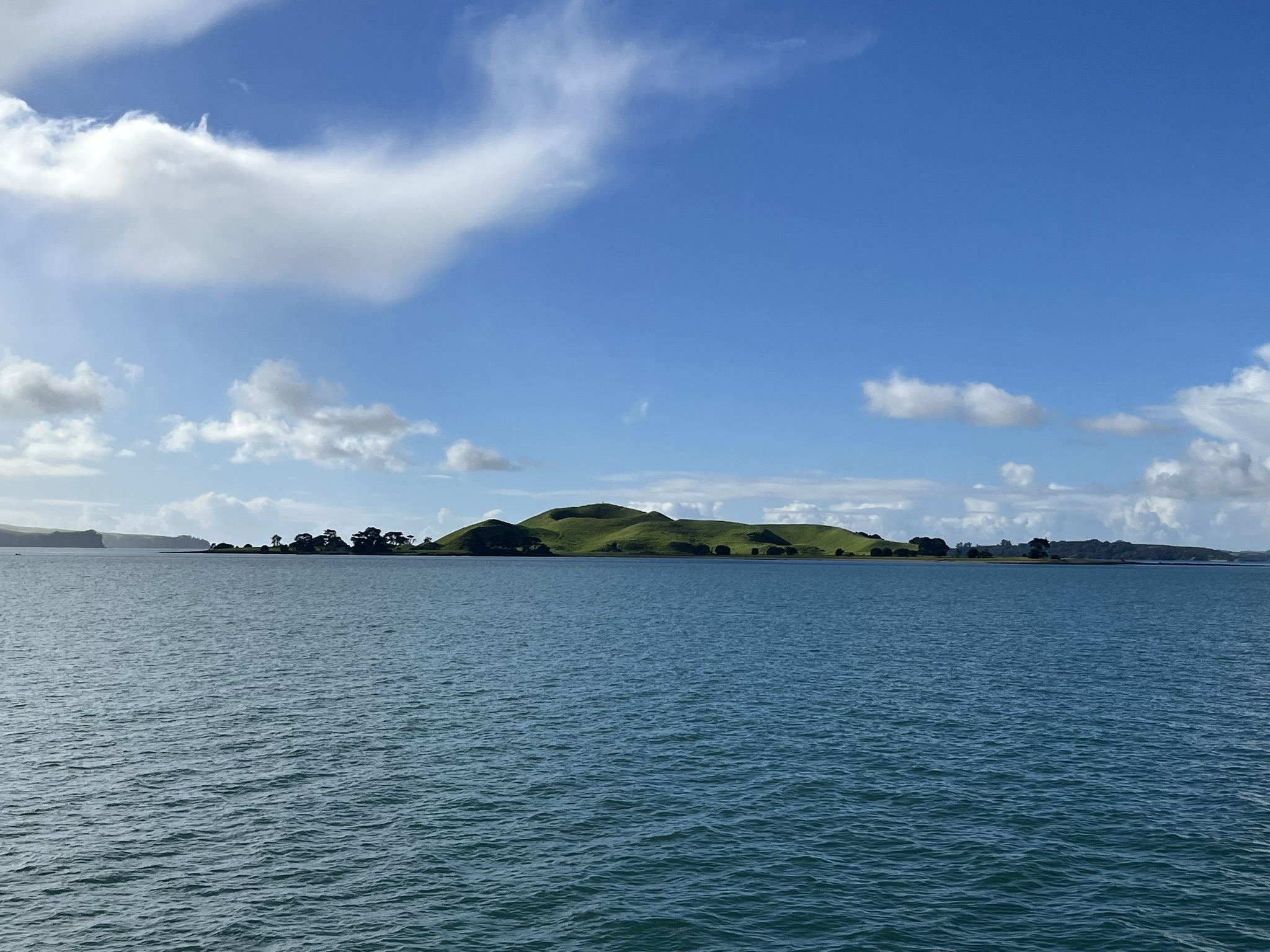 Browns Island on the way, an old volcano
With that sorted out I could finally start my way up Buckland Beach (which is a peninsula not a beach, weird name). I followed the beachfront for maybe two kilometres, and then turned inwards to go get a traditional NZ pie, just to discovered that it was closed on weekends. So with no pie I then ventured out onto the tide revealed sand flats and entered the nature I had come for.
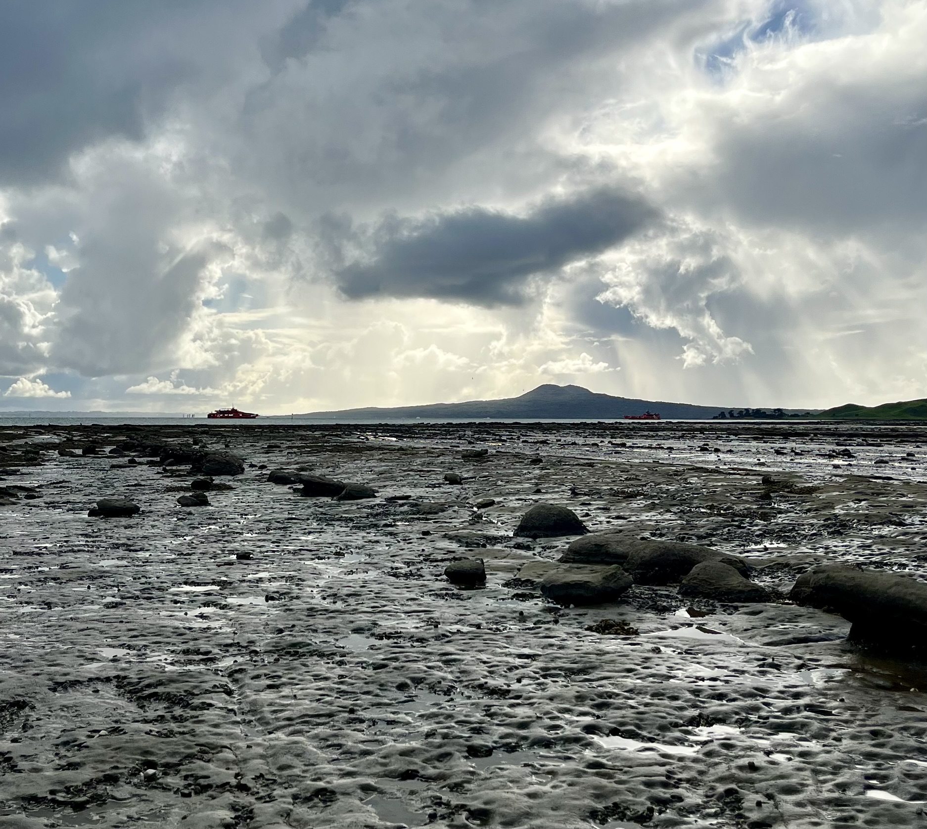
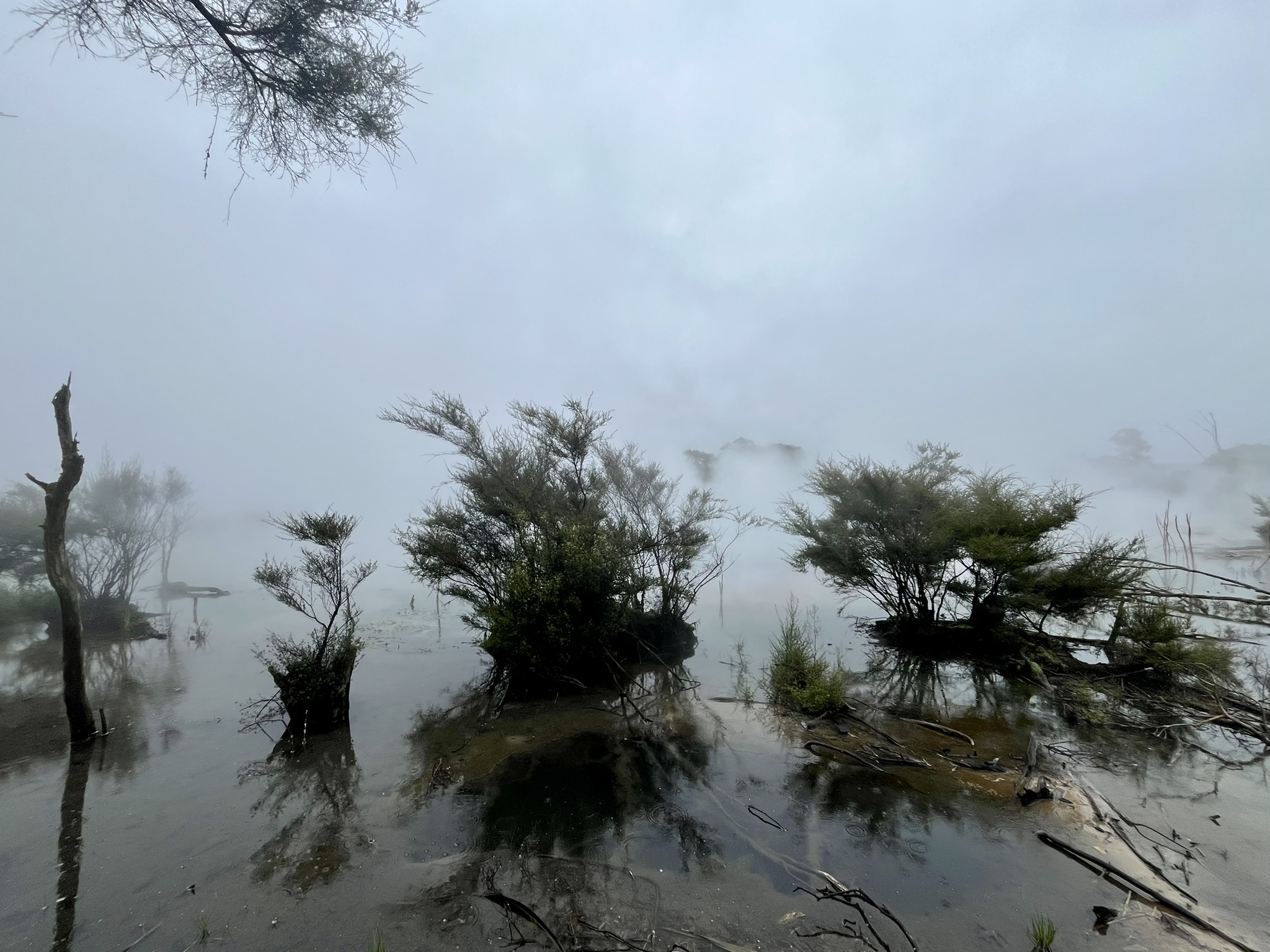
This is probably one of the landscapes I have come to love the most here in New Zealand. The sea on one hand, and the sandstone and clay cliffs eroding on the other, with great trees partly falling down them. I got out here just before low tide, with the sand flats being probably a 100 meters wide from cliff line to the water edge. The walk to the outermost point was around 1.5 kilometres, and along the way I found some small caves, funny stone formations poking out of the sand and a lot of beautiful shells. Further out I met banks of lovely green seaweed by the water edge, and a lot of seabirds. And of course the light was really amazing, standing in the sun while all around me were rain clouds, made for some truly spectacular photos if I do say so my self.
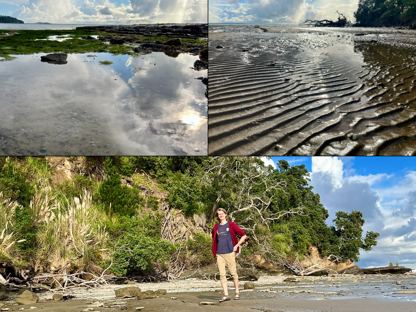
And this trip was very much a photography experience, for one because of the light being so inviting. But also because I had figured out that I could use my backpack as a impromptu tripod for my phone which enables so many more setups with a human (me 🙃) in the shot. Previously when I wanted to take a photo with me in frame it relied on there being a good tree nook or scraggly rock where I could lodge my phone in. But now I just had to try and balance my, surprisingly hard to balance, backpack which opened up a whole host of new possibilities. Though still involving running a lot to get into frame in the 10 seconds timer.
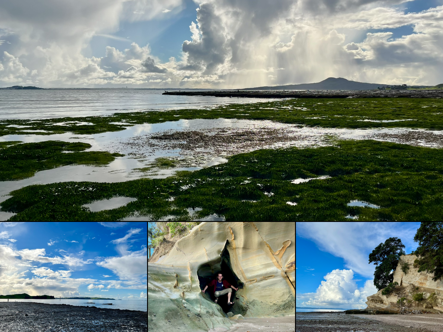
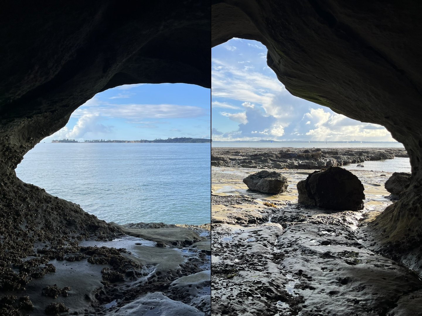
I reached the furthest point of the peninsula, Musick Point, and with it the tiny rock island or formation just beyond the main peninsula, accessible now when the tide was out. Which, like a lot of the sandstone around here, was a lovely eroded rock formation, including a really nice whole through it with a small air went up as well. Then I spent maybe 40 minutes out there on the rock, making quite a poor sketch of the headland and taking photos.
Starting back, I was happy to discover that there were in fact a staircase off the foreshore, which made my journey back much easier. I climbed up those stairs and went past the Art Deco military radio station turned War Memorial. Then continuing along the top of the cliffs for a while before walking through the Golf Course situated on the peninsula. Finally, getting back to the suburbs and walking along the beachfront, before getting on a bus back home.