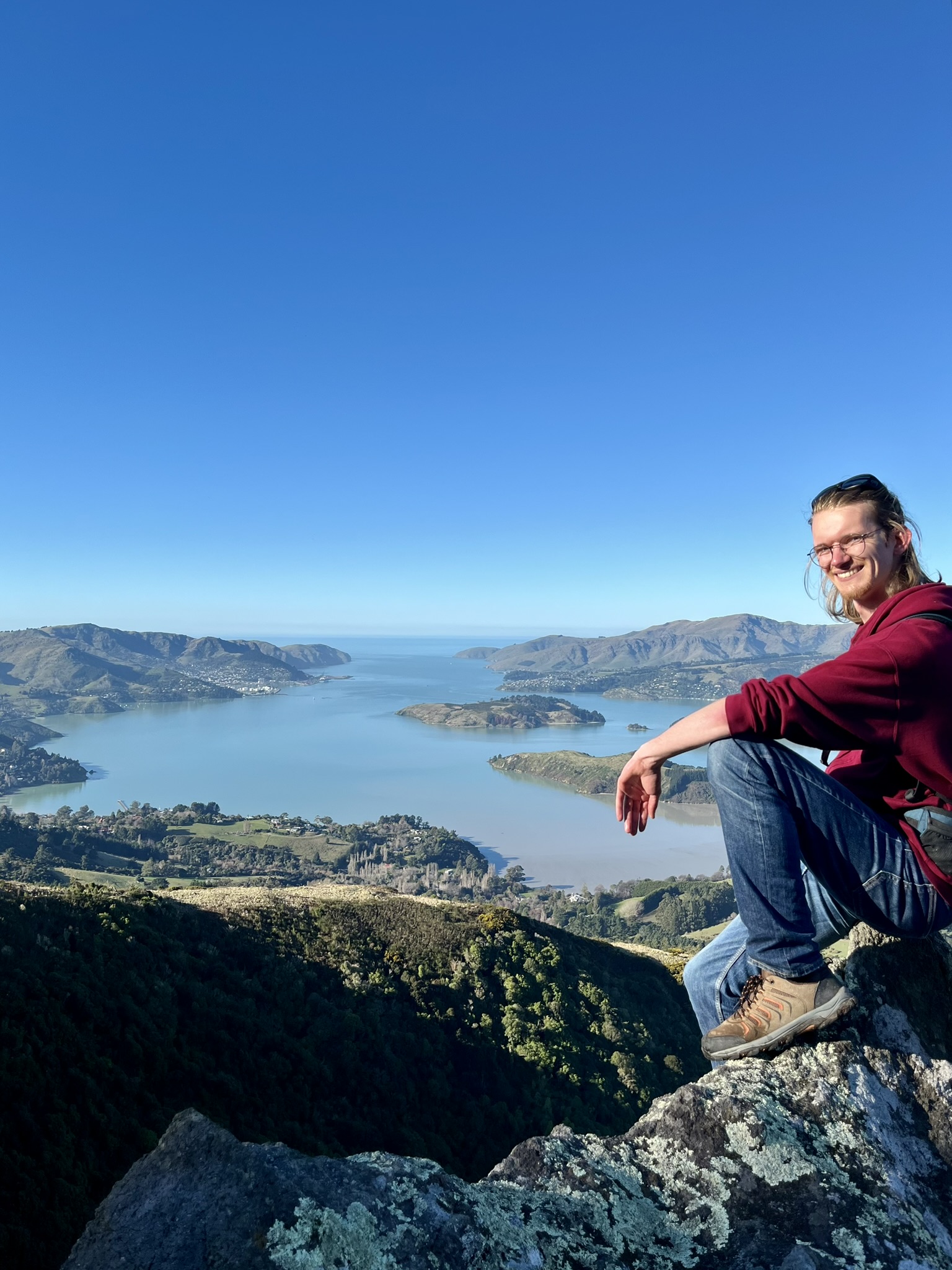
Cape Reinga
Cape Reinga, such an illusive target. I knew from the beginning when I started to plan this trip that Cape Reinga would be one of my goals. The top of New Zealand, the clashing point of the Tasman Sea and Pacific Ocean, and fond memories from 2013. But it is a long, long way out to it, longer than I had realised until I started doing my concrete planning in the Bay of Islands. Even with staying at the closest reasonably priced place in Mangonui, I would have a close to two hours drive to get there, and then another one and a half hour drive back down the Aupōuri Peninsula to my first possible place to stay in Kaitaia.
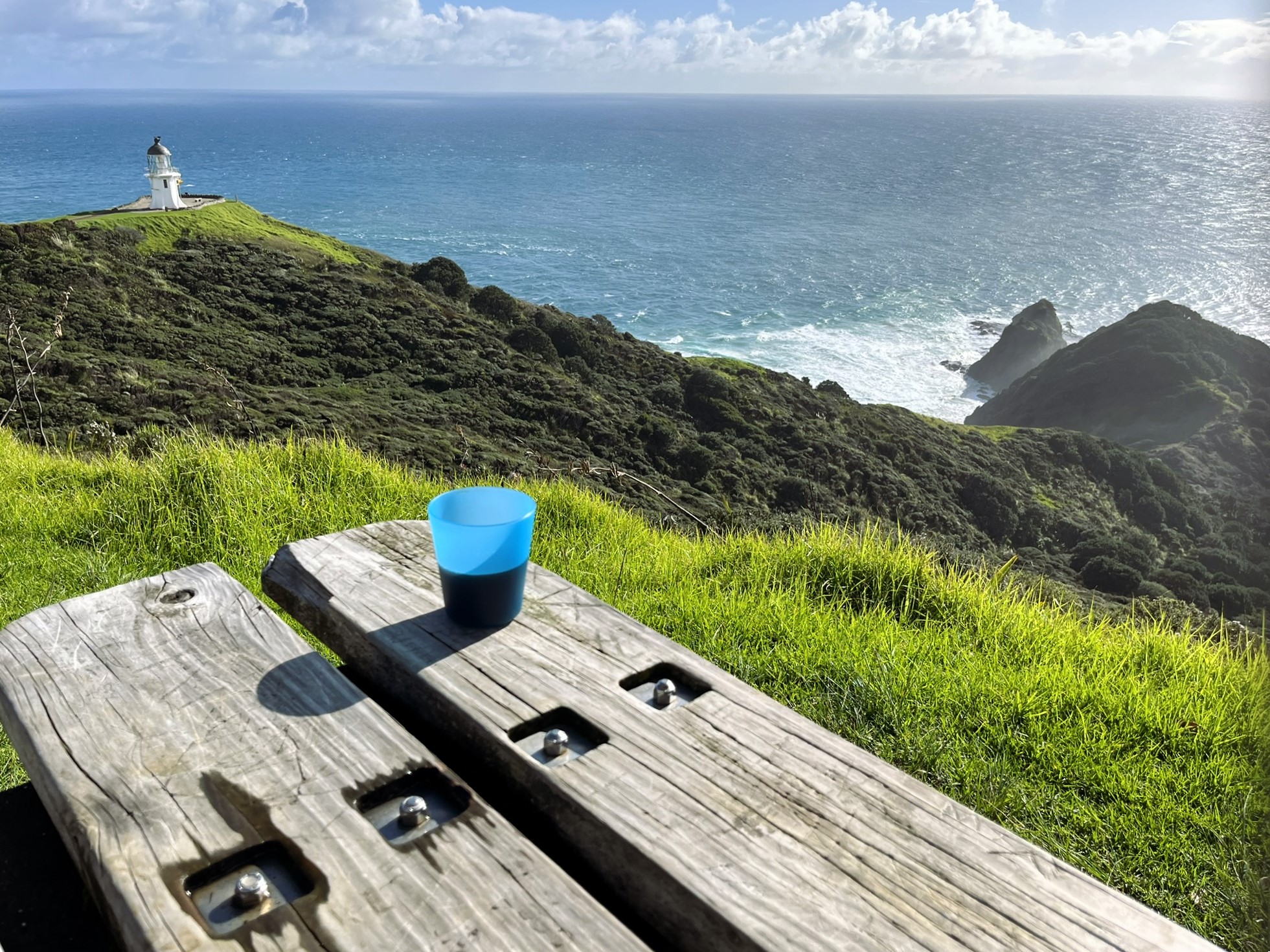
So with that knowledge, I had an early breakfast in the very bare-bones kitchen at the hotel in Mangonui, prepped my lunch (tuna sandwiches) and boiled coffee water, and I was off. Arriving two hours later at about 10:30 at Cape Reinga and I started off my visit with enjoying some of said coffee together with the amazing view on a really incredibly nice day.
Next I went down to the famous lighthouse, where I had the absolutely incredulous luxury to be alone, for like 15 minutes. Which I feel like shouldn’t happen, ever, and especially on such a nice day. Enjoying the view of the clashing oceans (I mean not really, our ocean delineation is completely arbitrary, but there is definitely some turbulent water meeting from up the different coasts). Then trying my best for some solo photos to celebrate the occasion, with varying results 😅
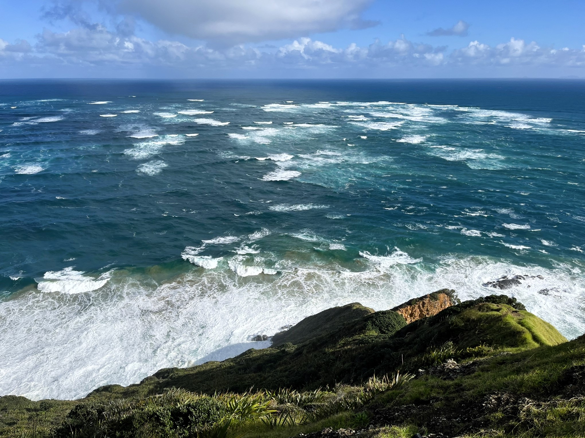 The clashing of the Tasman and the Pacific
Then something absolutely unreal happened, we were graced with a rainbow over the Cape Reinga Lighthouse. Which, if I think of it critically, might not be that uncommon, considering the very unstable weather of New Zealand. But still, to have that sort of thing happen to you, when you are basically alone at one of the largest tourist attractions in the country, on a day with perfect weather, feels like a blessing. I guess that’s one of the perk of doing this in the middle of winter.
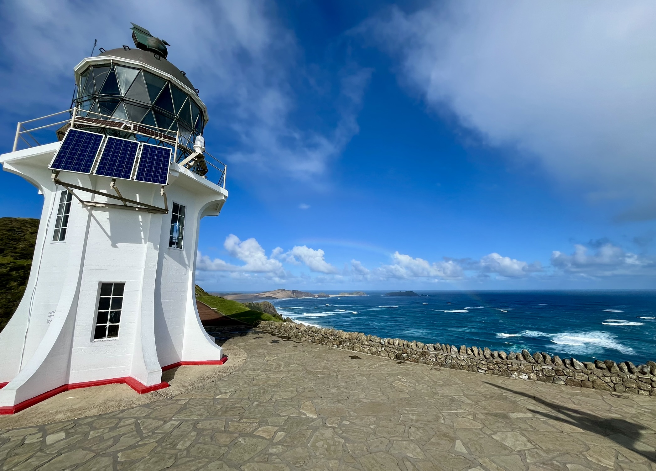 Rainbow over Cape Reinga, looking towards Cape Maria Van Diemen
After my visit to the lighthouse, my plan was to hike down the cliffs to the south, and along the long beach over to Cape Maria Van Diemen which can be seen under the rainbow in the picture above. So after going back to the car to get my tuna from my chilly bin (yes, they call it that here), I was off. The walk started out along the edges of some absolutely stunning cliffs, offering both great views up towards the lighthouse, and a hundred-meter drops into the foaming ocean below. Luckily for me, I met a pair of friends going the other way which were kind enough to get some really cool photos of me. Though they did warn me that you couldn’t get out onto the beach due to the high tide.
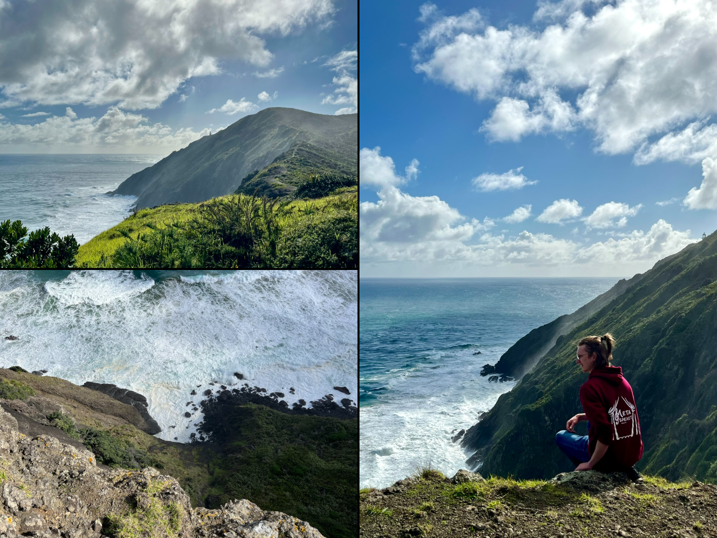
But I didn’t let that deter me, I am a good scrambler and was at the very least going to go and take a look for my self. Said and done, I continued down the cliffs and could soon see how the waves were indeed rolling in and covering the whole beach, but only at their furthest reach. And when I finally did get down to the beach, I didn’t find it too much of a challenge to quickly walk the open sand between waves, and then scramble along the seaweed and shellfish strewn rocks, climbing further up when the waves came in.
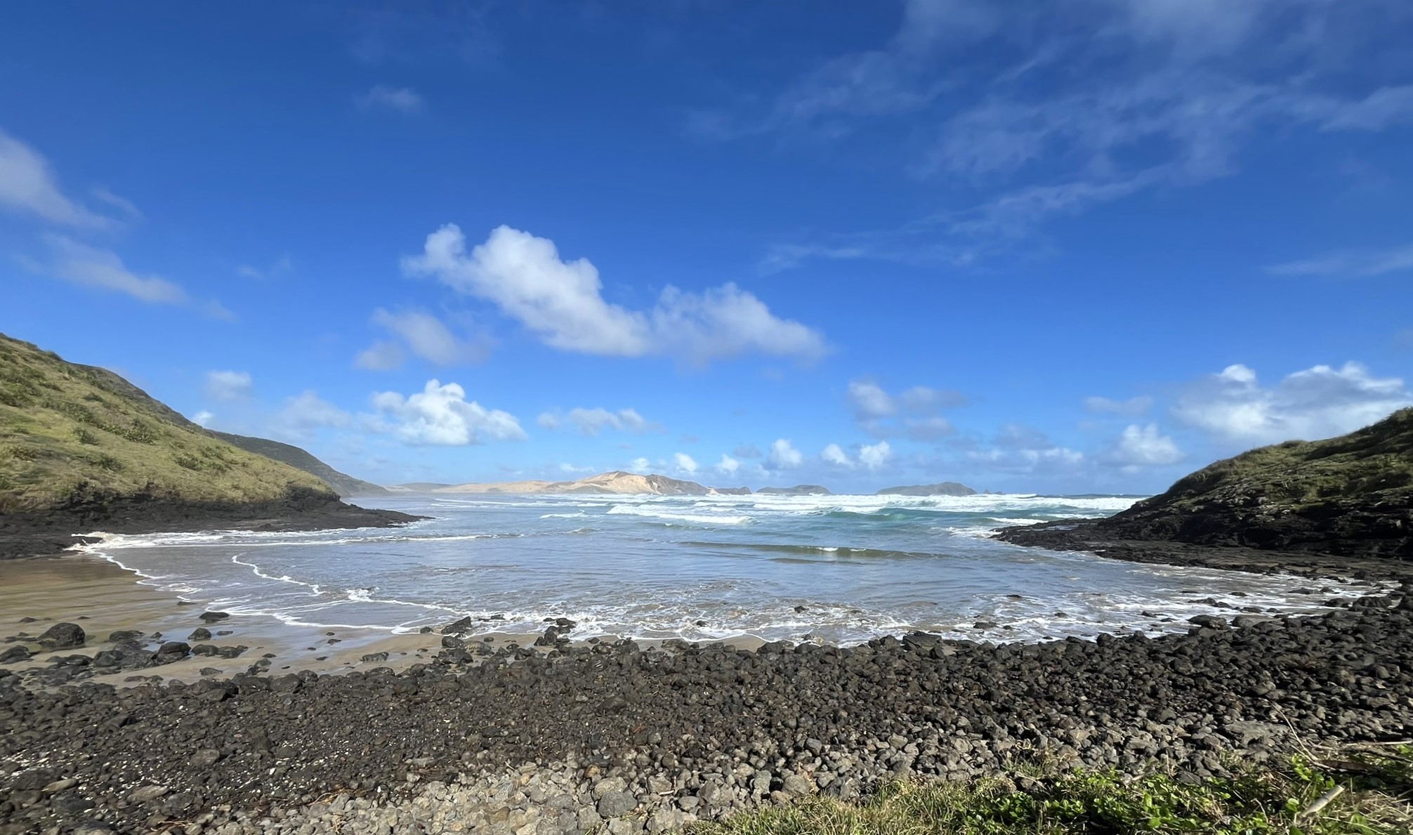 The Beach Crossing
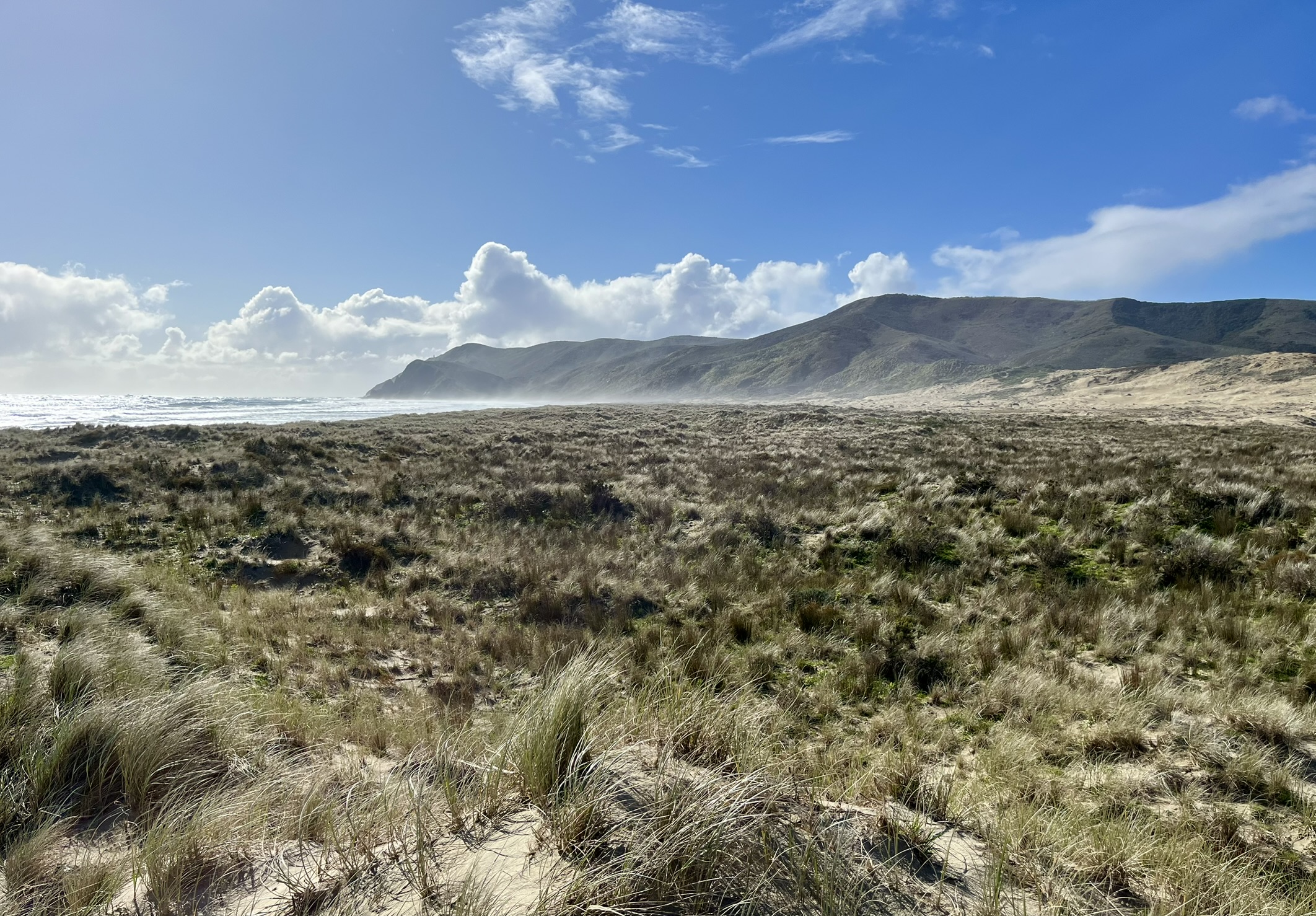
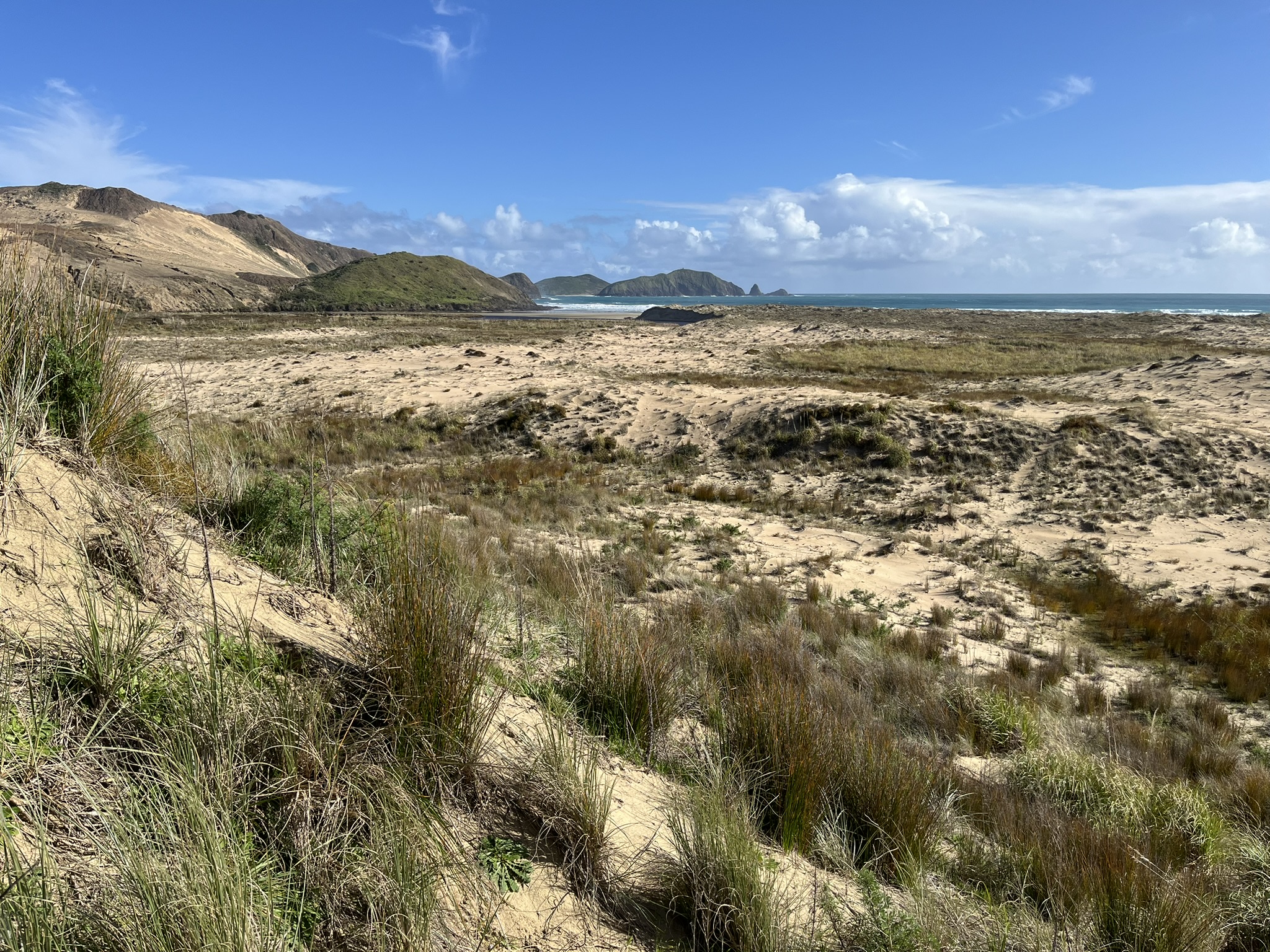
And then I was out on the beach, and what a beach it was. Flanked on the left by a field of sand dunes spreading out from the high hills, in the background the sandbank peninsula of Cape Maria Van Diemen, and the rolling sea on the right. And it’s long too, three kilometres of white sand before the foothills of the peninsula. I had a really amazing walk down this lovely beach, just enjoying the birds, and the occasional look back towards Cape Reinga looking absolutely stunning in the fog.
As I was getting closer to my goal, I met a pair of well-equipped trampers coming the other way, and we exchanged some tips about the route in either direction. And this is when I learned that there is apparently a river reaching the ocean just before the peninsula, requiring fording. How this was not marked out on any of the maps I had checked is beyond me, not anything on neither AllTrails, the signs at the visitor centre, nor on Google Maps (though it is very visible on the satellite view). My plan was either way to return by climbing the hills on my left, so this didn’t really change anything. And so I continued onwards to see how bad of a river it was.
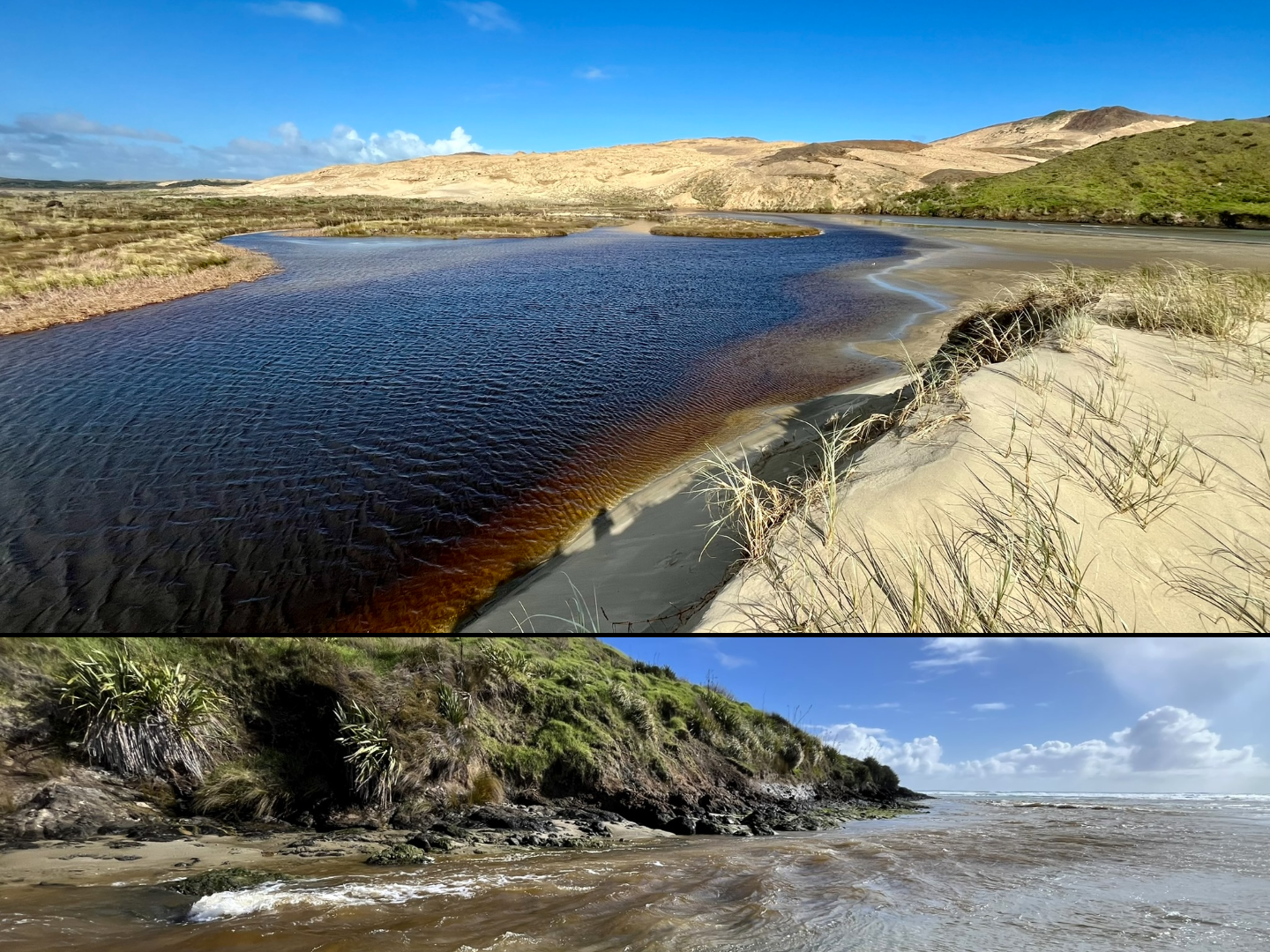
It was bad, like it was a real river, and while more shallow on the beach, it was instead very rapid. And I quickly decided that I did not have the equipment for this, and also it had already been quite a long walk. So instead I found myself a nice bush on the dunes to have my lunch on, which was really nice after the walking, with another rainbow and some stunning scenery.
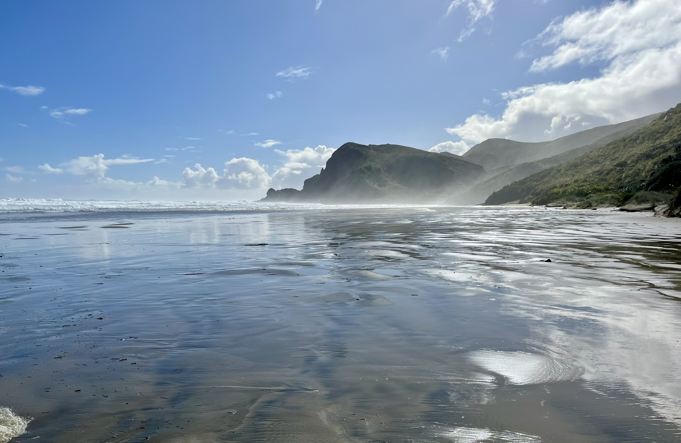
 There are worse places to have lunch
Reinvigorated by the meal, I now turned my attention to finding the supposed track which should lead from here up to the car road. Walking back and forth across where it was marked on my map, I thought I could kinda see it. And because this was on sand dunes (which move) I wasn’t so surprised that the path wasn’t visible. Instead, I decided to follow the closest thing to a path I found, while keeping an eye on Google Maps. After maybe five minutes of walking I found a clear track marker, which had fallen over, and reassured by that I continued my track. First onwards over the dunes, and then up the sloping sandhill, where I found a cow track to follow (though it took me maybe 10 minutes to remember that it was a cow track and not a horse track).
 View over the dunes
This is where I probably should have turned back, as I was greeted by a thick bush landscape. But I had found something of a path, and even as the bushes turned to meter tall grass mixed with small trees, I kept on finding and then losing the path which kept me going. When I finally came to the conclusion that this had been a bad idea, I had worked myself a kilometre into the thicket, often wading through grass reaching my breast, or climbing over the small fallen trees (who seemed to have burnt at some point). But by then I felt like I was in to deep to turn back, and that it was a shorter bash just to continue onwards. And somewhere during this endeavour I lost my headphones to boot, thank god it wasn’t something actually important like my key or phone.
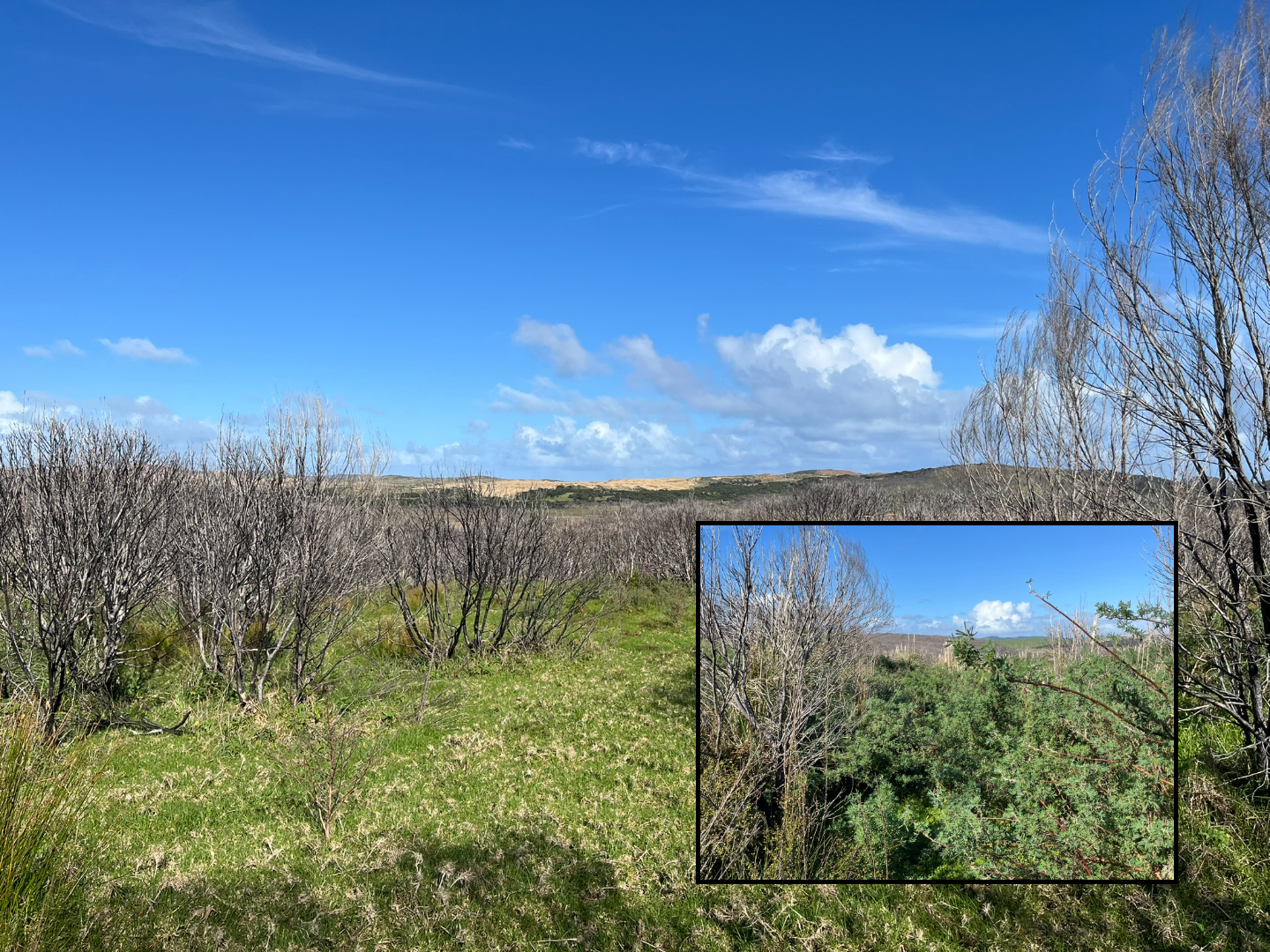 This may not look bad, but that green floor cover is more than a metre deep
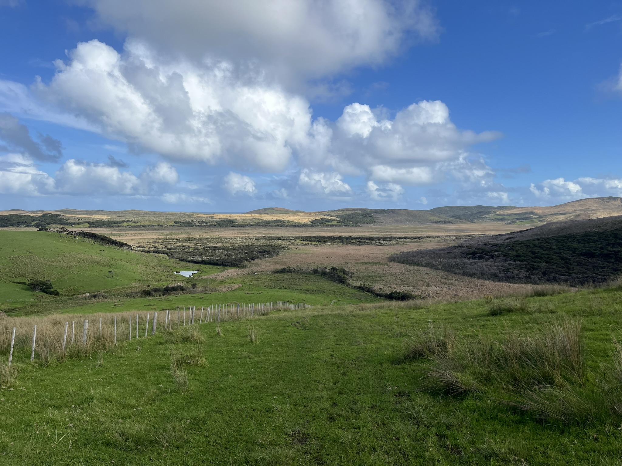
In the end I waded through a kilometre of this grass (as the crow flies, no clue how far I actually walked), before finally having it let up slightly as I reached the end of the hill. I traversed that slope sideways to try and get back to where the path was supposed to be. And lo and behold, there was the path, wide and easy to walk, leading down into a bit of a march but with nice plank walks. Followed by about a two kilometre climb back up to the road through a sheep pasture (really thankful it wasn’t a cow pasture). And there when I got to the end of the track I found a big sign saying Closed, No Entry.
Thanks, I could have done with that knowledge before starting. Again, this was not mentioned on any of the maps I had checked. But that is what we call Type II fun, right. Makes a good story anyway. Now I only had five kilometres of walking back along the car road to the Cape Reinga car park. Which I was not looking forward to as I was quite exhausted by this point. But what do you do, so I started walking while making some attempts to hitchhike from the few cars passing by. And about halfway back, my luck turned, with Becky (who I shared room with at the hostel in the Bay of Islands) picking me up, happy days!
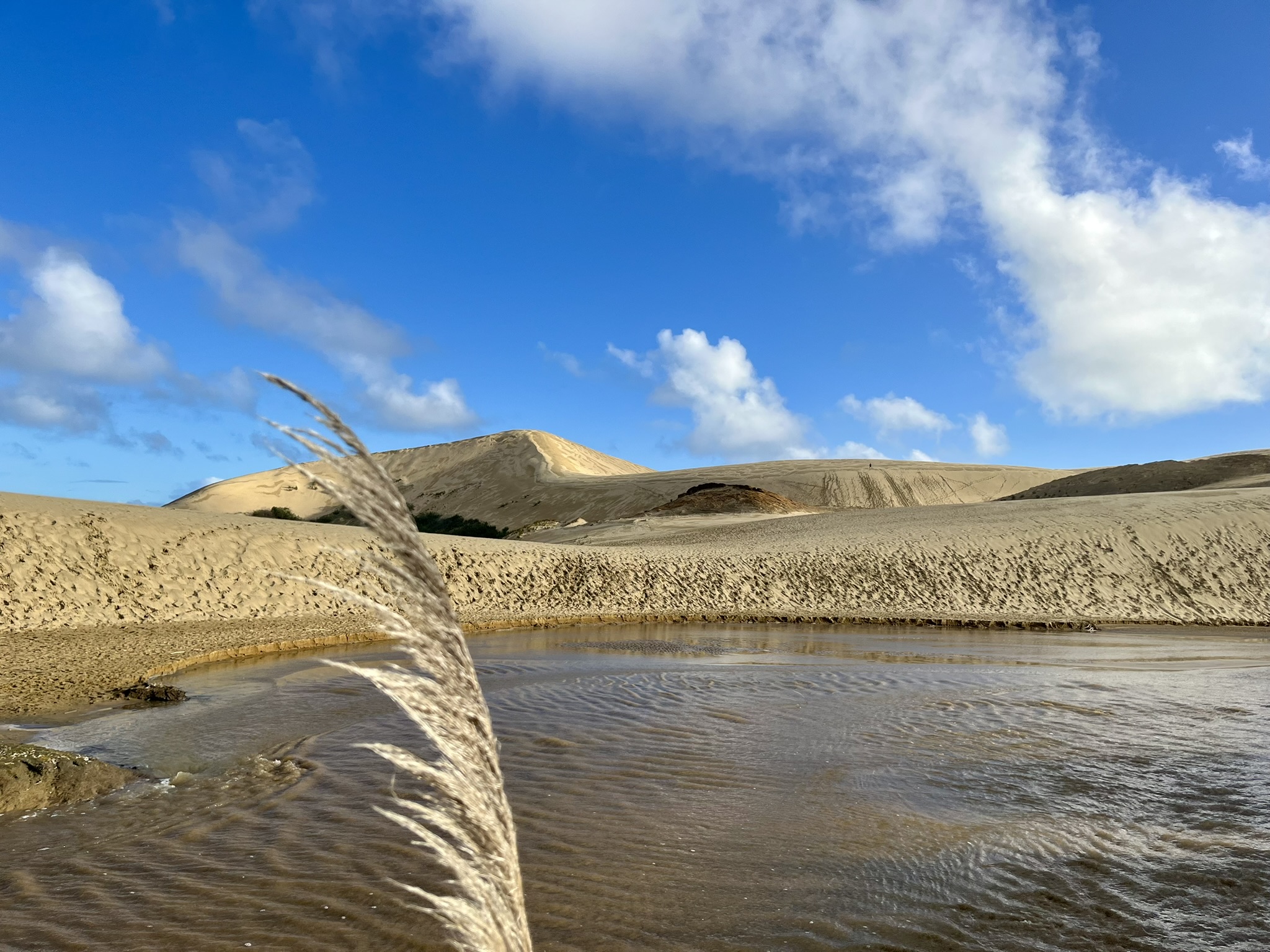 The Giant Sand Dunes
After a very well deserved coffee at the car park, I started on my drive back. I had planned to visit the Giant Sand Dunes, but it was only a very short stop and no sand surfing, as my heart wasn’t really in it after such a long day and with some significant driving left. So just a quick in and out, though I did see a falcon feasting on something on the road, which was cool. Though I would learn that they are quite a common sight during the rest of my trip, probably due to the abundance of road killed possums (they are an invasive species which cause a lot of harm to the native birds, so some locals do the opposite of trying to avoid hitting them). Then driving the last hour back down the Aupōuri Peninsula to Kaitaia.